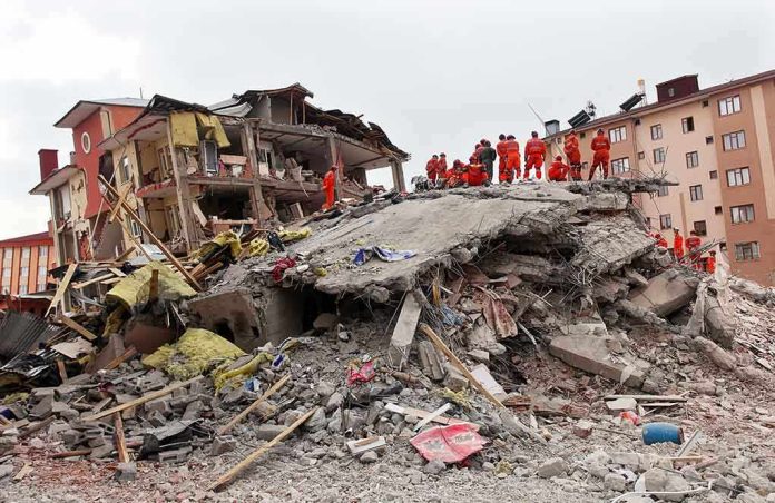
Rescuers raced through rubble in western Colombia after a powerful earthquake left Pereira among the hardest-hit cities and pushed airports, hospitals, and roads into crisis.
Quick Take
- The earthquake struck western Colombia at magnitude 7.4 around 7:34 a.m. local time.
- Pereira was widely reported as one of the cities hit hardest by the shaking and collapse damage.
- Multiple reports say airports in the region were affected, and flights were suspended while damage was checked.
- The airport-specific damage claim is supported by broad reporting and social video, but the supplied record lacks a direct official Matecaña statement.
The Quake That Changed the Morning
The earthquake hit with the kind of violence that turns a normal morning into a rescue operation. Reuters, the BBC, and other outlets reported a magnitude 7.4 quake in western Colombia at about 7:34 a.m. local time, with strong shaking felt across a wide area. The quake was severe enough to trigger emergency measures, widespread evacuations, and urgent searches for people trapped under collapsed buildings.
Pereira quickly emerged as one of the most important places in the story. Reuters and Al Jazeera reported deaths and building collapse in the city, while other reporting described rescuers searching through rubble there. Bloomberg and regional coverage also placed Pereira among the cities with the most visible damage, which helps explain why attention turned so fast to the airport and other critical sites in the area.
Why Pereira Became the Focus
Pereira matters because it sits in a region where public buildings, roads, and transport links can be lifelines after a quake. When a city takes hard shaking, people look first to hospitals, highways, and airports. Reuters reported damage to hospitals and infrastructure, and Mercopress said the quake was affecting six airports. That broader disruption makes Pereira a natural place to expect operational trouble, even before every site is documented in detail.
That is also why the airport claim spread so fast. Social video and headline-driven posts tied the quake to damage at Pereira airport, and one YouTube title explicitly linked the earthquake to airport collapse reporting. Those items do not replace official records, but they show how the airport became part of the public picture almost immediately. In disaster news, the first visual evidence often shapes the story long before engineers finish their checks.
What the Record Strongly Supports
The strongest facts are not in dispute. The quake was real, powerful, and widely felt. The reporting consistently places it in western Colombia near San José del Palmar or the Chocó region, and several outlets say it ranked among the country’s strongest quakes in years. The damage reports also line up: collapsed buildings, trapped residents, emergency declarations, and major disruption across several cities.
The airport-specific claim is more limited. The supplied record does not include a Matecaña International Airport bulletin, a civil aviation notice, or a structural inspection report naming the airport and describing the damage. Instead, the evidence is indirect: broader reports that airports were affected, plus social and video items that mention Pereira airport by name. That is enough to make the claim plausible, but not enough to pin down the exact damage with certainty.
What Still Needs Confirmation
The missing piece is the kind of document that ends argument: an airport operator statement, an emergency log, a runway inspection, or a post-quake engineering report. Those records would show whether the airport suffered only shaking and brief disruption, or something more serious. Until that appears, the safest reading is simple. The earthquake clearly hit Pereira hard, and the airport was likely in the zone of disruption, but the exact scale of Matecaña damage remains underdocumented in the material provided.
Speaking of seismic
the situation in Colombia is now extremely serious.A magnitude 7.4 earthquake struck western Colombia on Monday.
At least 164 people are now reported dead, with the toll expected to rise as rescuers reach collapsed buildings.
Cali, Pereira and Manizales…
— Chaya Eitan (@ChayaEitan) August 11, 2026
That gap matters because disaster coverage often moves faster than verification. The public sees the quake, the rubble, and the rescue crews first. The paperwork comes later, if it comes at all. For readers trying to separate solid fact from fast-moving rumor, the key point is that the regional destruction is firmly established, while the airport story still rests on indirect evidence and footage rather than a direct official airport record.
Sources:
youtube.com, bbc.com, aljazeera.com, en.wikipedia.org, theguardian.com, earthquakelist.org, news.cgtn.com, cebudailynews.inquirer.net, bloomberg.com